|
This week more schools, especially up north, are back in session. Here’s a geography warm-up for your academic muscles. This is a US map. Find these 4 states -- Minnesota, Michigan, Ohio, and Florida. 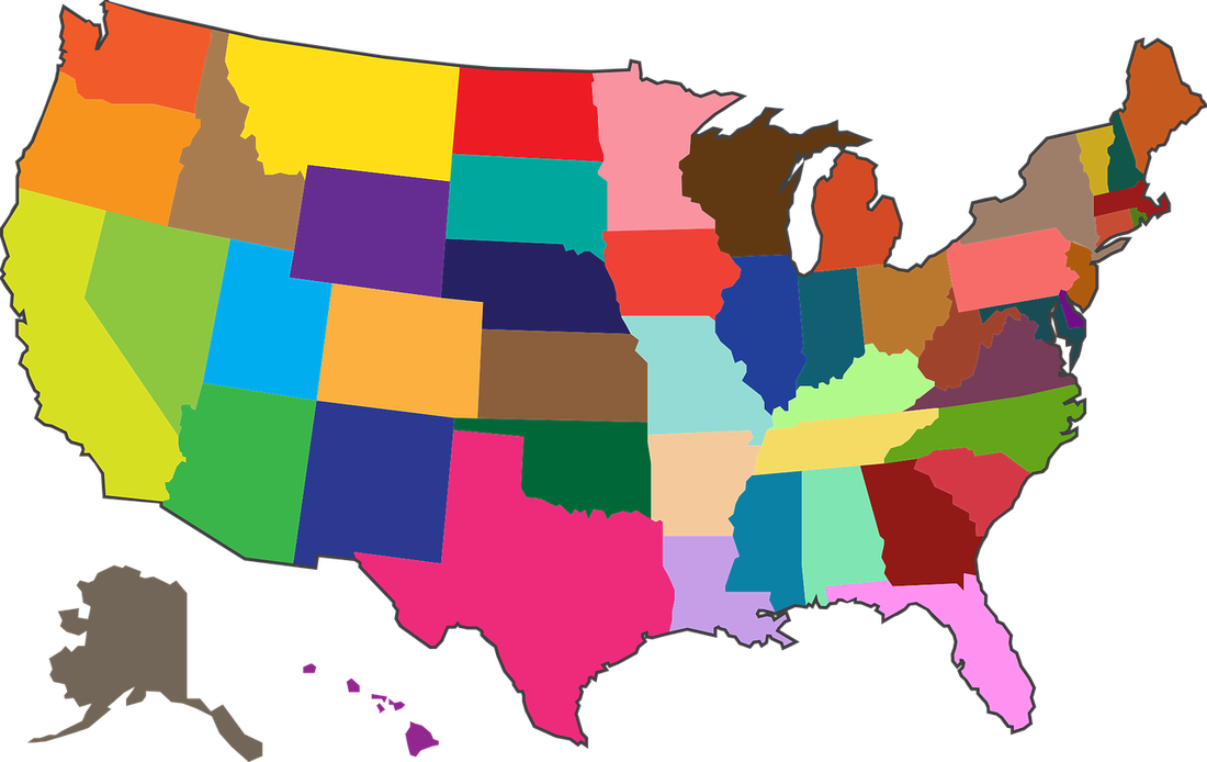 Question #1 Which state has the longest freshwater shoreline in the United States? Hint – it’s up north! Minnesota Michigan Ohio Florida I listed the states from west to east. Minnesota is the farthest west, and Florida is the farthest east. And the answer is . . . Michigan!
Only Alaska beats Michigan with a shoreline of 6,640 miles, but it’s almost all saltwater. Sources: Michigan.gov | Date Updated: June 27, 2019 https://www.traveltrivia.com/answer-what-state-has-the-longest-freshwater-shoreline-in-the-country/ This is a satellite picture of the Great Lakes. I guessed wrong, but I was close. Question #2 – How many are there? 4 5 6 7 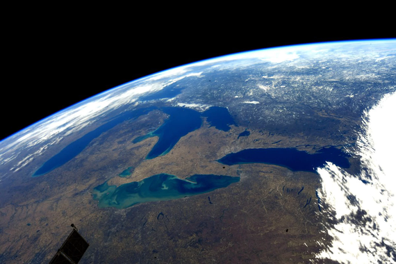 And the answer is . . . 5. I guessed 6. See I was close, but I always told my 2nd graders close counts in horseshoes, but not in math. Or on questions like this. ***** Now look below at the satellite picture of North America. The red box shows how much space the Great Lakes take up. I don’t think I can answer the next question correctly. How about you? Question #3 – Can you name the Great Lakes in order, going from west to east? 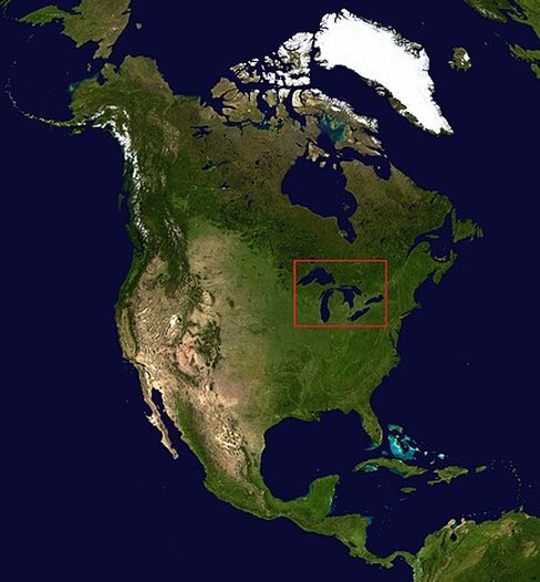 And the answer is . . . Superior, Michigan, Huron, Erie, and Ontario. I tried to answer without any help. I had Lakes Huron and Superior switched around, and I couldn’t remember Ontario. Two out of 5 right, not so great! YIKES! 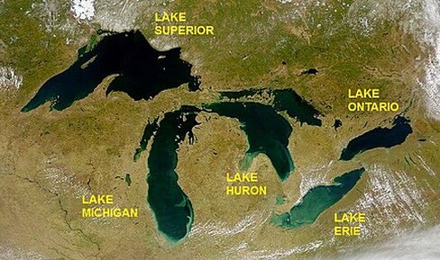 Remember that state to the north, the ‘M’ one? Can you see it on the two maps above? 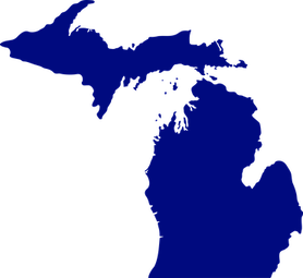 I pasted a map of Michigan to the left. Lake Michigan forms the western border. Lake Huron and Erie make the eastern border. Lake Erie also forms part of the southern border between Ohio and Michigan. Did you know when they formed them, there was a war over who got Toledo, which sits on Lake Erie? Ohio won – we got Toledo, and Michigan got the Upper Peninsula. Question #4– Which is the Deepest of the Great Lakes? Huron, Michigan, Erie, Superior, or Ontario. I have no idea. How about you? Take a look at this table, and I bet you can find the answer. My source: 1. EPA 2. https://www.epa.gov/greatlakes/physical-features-great-lakes 3. https://quizzclub.com/games/bonus/which-is-the-deepest-of-the-great-lakes/answer/2006/  Huron Michigan Erie Superior Ontario 750 925 214 1332 802 Depth in feet 22 99 2.6 191 6 Retention time Retention time is the average time water spends in a lake. To find it, divide the lake volume by the water flowing in or out. And the answer is . . . Superior! It IS Superior! It’s the deepest, at 1332 feet deep, the coldest, and the farthest north. Water stays in the lake for about 191 years before it finally leaves. Can you find the opposite? It’s Lake Erie at only 214 feet deep with 2.6 years to stay in the lake. ****** The Great Lakes are 750 miles across. They hold 84% of the freshwater in North America, 21% of the worlds’ fresh water. They really are GREAT! Source: https://www.traveltrivia.com/answer-how-many-great-lakes-are-there/ Question #5 – How ere the Great Lakes formed? I found the answer in a picture. What do you think the answer is? Meteors Volcanoes Glaciers 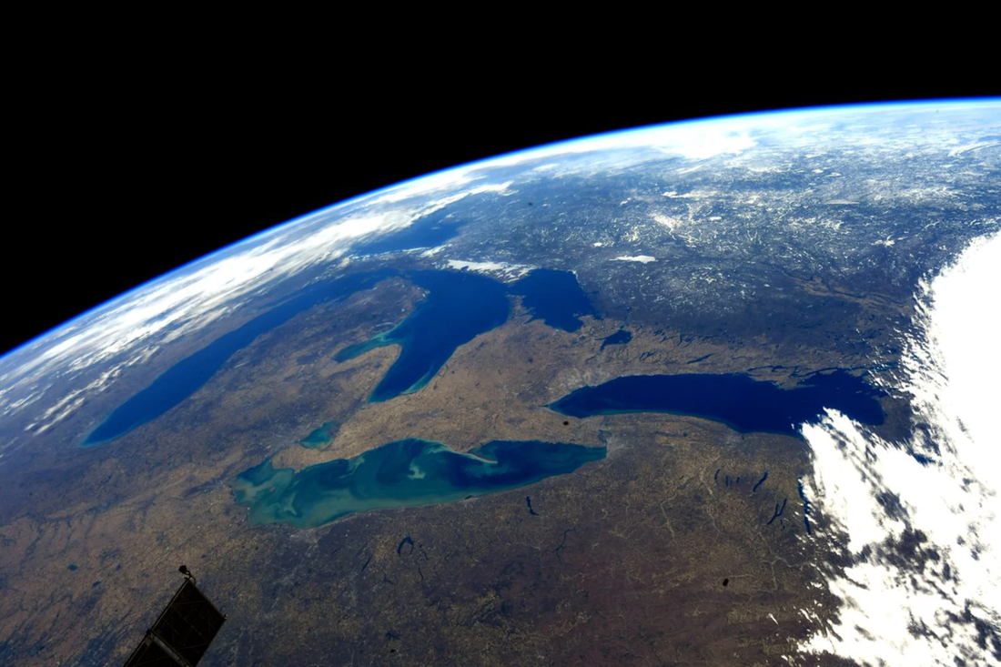 And the answer is . . . Glaciers. If you look at the illustration below, you see how the great glaciers covered all of Canada. I remember from Ohio History how they moved down through Michigan then down into Ohio. They reached Moraine, near Dayton, Ohio before receding north again. This illustration doesn’t show that, but it does show how the history of the Great Lakes in 4 illustrations. 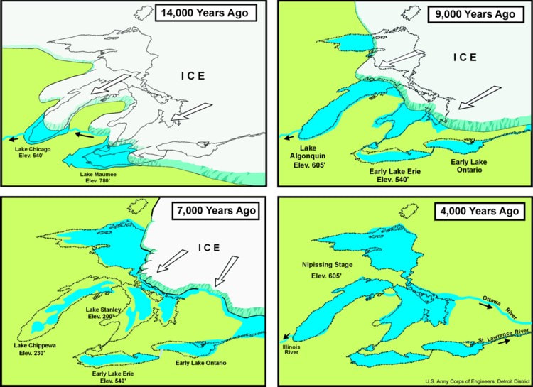 If you’d like to read more about the Great Lakes or find more great pictures, click on this link: https://en.wikipedia.org/wiki/Great_Lake
0 Comments
Your comment will be posted after it is approved.
Leave a Reply. |

AuthorWhen I write, I can only have one voice in my head, mine. A little noise is fine. But too much, or worse yet, WORDS, and I must change rooms or pull out headphones. Then I can write on! Categories
All
|

 RSS Feed